Location: Bang Phra, Sriracha, Chonburi
Trip Distance: 20kms (10kms asphalt/tarmac, 10kms dirt)
Start/Finish: Bang Phra Reservoir Parking lot
Jumpoff Point: The trail starts at point marked Detail A on the map from a 10km "warmup" ride on asphalt with very, very light traffic. The jumpoff is blocked by a makeshift gate to prevent light vehicles such as motorcycles and small 4x4 trucks from entering.
LAZY SUNDAY. Our group trip was cancelled for reasons only known to God himself so instead of spending the rest of the day playing DOTA, I decided to get off my ass and on my bike and look for the trail I've read in one of the threads at the Thai MTB forum.
Obviously, my trip started at my house at nearby Bangsaen. But for those of you who are interested in checking out this trail, I've marked the Start/Finish point at the Bang Phra Reservoir parking lot. Exit the parking lot, turn right at the gate and then turn left at the T-intersection with the golf course to your right.
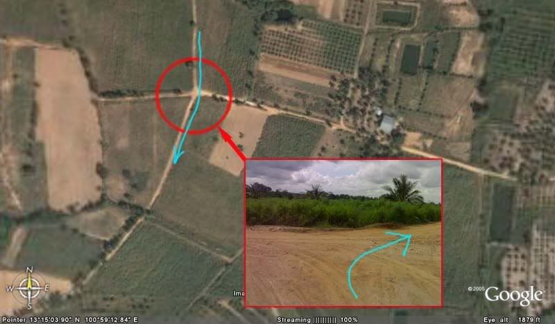
This road leads to an intersection marked DETAIL_B in the map. Turning left leads to a road very much under construction for about 600 meters. Lots of dust and gravel. Not much traffic but this should change once the road is finished as this road leads to Route 7 Motorway going to Bangkok.
Roughly 2kms from the intersection is a fork marked DETAIL_C in the map. Straight ahead will eventually lead to Route7 Motorway, turning right leads to the jumpoff point. I was chased by a very BIG dog from the house near this fork. The mountain is on the right side of the road. There are some trails leading to the mountain before the jumpoff which I'm sure leads to somewhere.
KEEP OUT?
Past the meditation center and rock quarry, I noticed the sheet gate to the right which matched the description and photos in the forum. I dismounted and carried my bike through the gap on the right side of the gate. Saddled, prayed, and off I went into the unknown.
The trail mostly fireroad with short singletrack sections. I can tell that it has been unused for quite some time by the thick grass unchecked on the sides and some vegetation reclaiming the packed soil on the trail. I did not bring eye protection so I had to shield my face from the thick grass early on. I occasionaly made loud clicking noises with my hand brakes to warn sleepy unsuspecting snakes.
I also noticed signs of alternate routes on the side of the track which shows that there was once a network of trails here for different levels of skills and fitness. I decided to go straight ahead, one exploration at a time.
BIG BREAK!
Beyond the trees and thick grass is a clearing overlooking Route7 Motorway. The sky looks very unfriendly. A ride on an unused trail in the rain sounds VERY inviting but not today, no sir.
I turned right with the Motorway on my left and the mountain on my right. This leads to a fork marked DETAIL_D on the map. I think the right path leads to the mountain trail. Mental note to bring machete next time and clear this path which I heard was once a competition race track.
ARROWS GENTLEMEN!
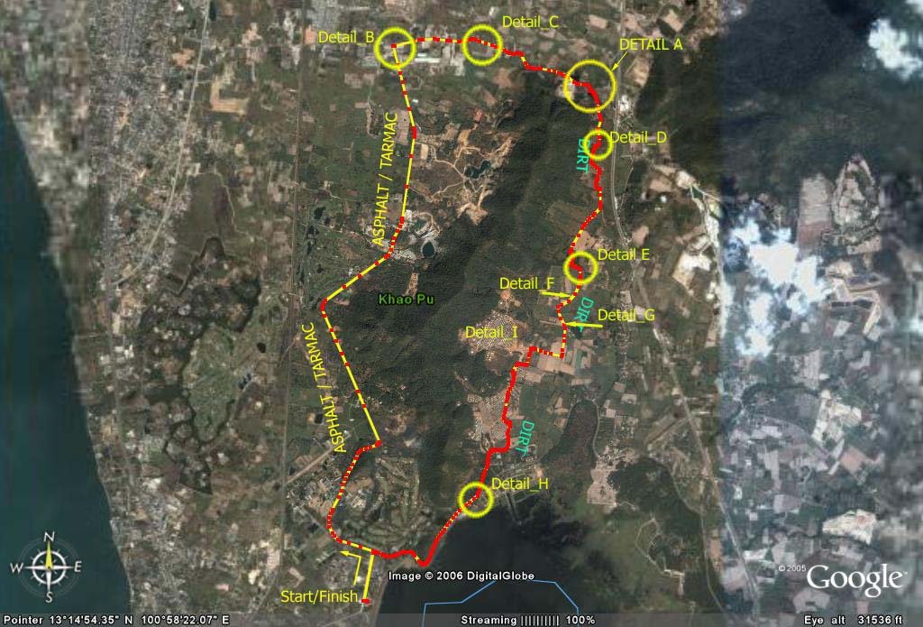
Then finally, a sign! Whew! I'm now officially un-lost.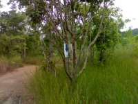 The sign is one of the familiar markers left by MTB groups from the popular LBS's here in Chonburi. Most of the trails around here are marked by these and I expect to see some more ahead and around the corner.
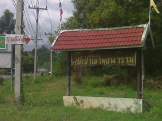
There are also no no entry markers indicating either housing/settlement, grazing field,bike hazard, or don't-cut-this-tree-dumbass!. Since I'm biking alone, I figured the locals wouldn't mind, I can outrun the cows, can always dismount, and am without an axe. I also forgot the symbol for mine field so I just ignored the sign and went ahead.
Sure enough, the trail is littered with these markers which I'm not sure were placed to help or confuse the rider. The markers are almost always nailed on trees and coconuts. They will almost always be behind thick vegetation and grass.
Then a pineapple field with real pineapples! A few more weeks and these babies will be ready for the picking and this field will be filled with the stench of rotten fruit and fruit flies.
WHERE ARE THE VILLAGE PEOPLE?
After couple more of confusing trail marks and through no entry X's, I found what used to be a settlement for a group of charcoal makers:
What used to be an area filled with, I guess, smoke and scraps of wood remains black soot and signs of human habitation. Old toys and makeshift chicken cages left behind to show that people once lived here. Watch a short video of this place here
Upon reaching the next fork Detail E in the map, I felt something was terribly wrong with my bag when it finally gave in to the abuse I've been giving it. I had to tie it with my handkerchief and constantly remind myself not to get carried away riding the rest of the track and unknowingly lose everything like a gingerbread trail behind me.
To the right of the fork Detail_F leads to sugarcane fields (and maybe a link to that racetrack) but I decided to make my damaged bag as an excuse to end this trip quickly, ignore that route, and go straight.
EXIT PLAN.
A little bit of exploration at Detail G rewarded me with a very short burst of adrenaline downhilling to a small pond and eventually a dead end. That reward was generously returned when I hammered my bike uphill back to the main route.
 A few more turns and up front I could see the Chinese Cemetery. So much for night riding here for me. Some graves have already been dug to make way to new tenants. This view is totally in contrast to the one opposite the cemetery. The mounds on the foreground are Chinese graves (or freeride jumps, depending on where and how you look at it). The mountain on the backdrop is a part of the range surrounding Khao Keow. There should be a trail around there somewhere!
Straight ahead and around the undertakers' cabins is just dirt road used by vehicles going in and out of the cemetery. There are people walking around doing their business of offering flowers to their beloved.
Unlike the confusing markers on the trail, the markers on this VERY wide dirt road were VERY clear and consistently pointing at the same direction. Seems like everybody knows how to get out of this place and would like to share that information. I wonder how many bikers have already been misled by these outdated markers only to get lost in the network of tracks beyond the graveyard and into the woods?
Fitness Level.
Beginners to "Occasional" Weekend Warriors. The first leg of the trip on asphalt can burn you out if you're not fit or not careful.
Technicality.
None. This is definitely Beginners-Build-Your-Endurance Level. This loop can cheer up a lot of people from those who are breaking-in their new bikes, son-and-dad trip outdoors, or speed-freaks looking for a bit of a cross-country fix.
Trip Value.
Hungry? No problemo, Bangsaen and NongMon market is less than 20 minutes away to the north and Sriracha is around the same distance away to the south. Drop by the beach, get a shuteye if you're tired or wake up that triathlete in you and do a few strokes. Richard talks more about Bangsaen Beach in his blog.
Trip Distance: 20kms (10kms asphalt/tarmac, 10kms dirt)
Start/Finish: Bang Phra Reservoir Parking lot
Jumpoff Point: The trail starts at point marked Detail A on the map from a 10km "warmup" ride on asphalt with very, very light traffic. The jumpoff is blocked by a makeshift gate to prevent light vehicles such as motorcycles and small 4x4 trucks from entering.
LAZY SUNDAY. Our group trip was cancelled for reasons only known to God himself so instead of spending the rest of the day playing DOTA, I decided to get off my ass and on my bike and look for the trail I've read in one of the threads at the Thai MTB forum.
Obviously, my trip started at my house at nearby Bangsaen. But for those of you who are interested in checking out this trail, I've marked the Start/Finish point at the Bang Phra Reservoir parking lot. Exit the parking lot, turn right at the gate and then turn left at the T-intersection with the golf course to your right.
This road leads to an intersection marked DETAIL_B in the map. Turning left leads to a road very much under construction for about 600 meters. Lots of dust and gravel. Not much traffic but this should change once the road is finished as this road leads to Route 7 Motorway going to Bangkok.
Roughly 2kms from the intersection is a fork marked DETAIL_C in the map. Straight ahead will eventually lead to Route7 Motorway, turning right leads to the jumpoff point. I was chased by a very BIG dog from the house near this fork. The mountain is on the right side of the road. There are some trails leading to the mountain before the jumpoff which I'm sure leads to somewhere.
KEEP OUT?
Past the meditation center and rock quarry, I noticed the sheet gate to the right which matched the description and photos in the forum. I dismounted and carried my bike through the gap on the right side of the gate. Saddled, prayed, and off I went into the unknown.
The trail mostly fireroad with short singletrack sections. I can tell that it has been unused for quite some time by the thick grass unchecked on the sides and some vegetation reclaiming the packed soil on the trail. I did not bring eye protection so I had to shield my face from the thick grass early on. I occasionaly made loud clicking noises with my hand brakes to warn sleepy unsuspecting snakes.
I also noticed signs of alternate routes on the side of the track which shows that there was once a network of trails here for different levels of skills and fitness. I decided to go straight ahead, one exploration at a time.
BIG BREAK!
Beyond the trees and thick grass is a clearing overlooking Route7 Motorway. The sky looks very unfriendly. A ride on an unused trail in the rain sounds VERY inviting but not today, no sir.
I turned right with the Motorway on my left and the mountain on my right. This leads to a fork marked DETAIL_D on the map. I think the right path leads to the mountain trail. Mental note to bring machete next time and clear this path which I heard was once a competition race track.
ARROWS GENTLEMEN!
Then finally, a sign! Whew! I'm now officially un-lost.
 The sign is one of the familiar markers left by MTB groups from the popular LBS's here in Chonburi. Most of the trails around here are marked by these and I expect to see some more ahead and around the corner.
There are also no no entry markers indicating either housing/settlement, grazing field,bike hazard, or don't-cut-this-tree-dumbass!. Since I'm biking alone, I figured the locals wouldn't mind, I can outrun the cows, can always dismount, and am without an axe. I also forgot the symbol for mine field so I just ignored the sign and went ahead.
Sure enough, the trail is littered with these markers which I'm not sure were placed to help or confuse the rider. The markers are almost always nailed on trees and coconuts. They will almost always be behind thick vegetation and grass.
Then a pineapple field with real pineapples! A few more weeks and these babies will be ready for the picking and this field will be filled with the stench of rotten fruit and fruit flies.
WHERE ARE THE VILLAGE PEOPLE?
After couple more of confusing trail marks and through no entry X's, I found what used to be a settlement for a group of charcoal makers:
What used to be an area filled with, I guess, smoke and scraps of wood remains black soot and signs of human habitation. Old toys and makeshift chicken cages left behind to show that people once lived here. Watch a short video of this place here
Upon reaching the next fork Detail E in the map, I felt something was terribly wrong with my bag when it finally gave in to the abuse I've been giving it. I had to tie it with my handkerchief and constantly remind myself not to get carried away riding the rest of the track and unknowingly lose everything like a gingerbread trail behind me.
To the right of the fork Detail_F leads to sugarcane fields (and maybe a link to that racetrack) but I decided to make my damaged bag as an excuse to end this trip quickly, ignore that route, and go straight.
EXIT PLAN.
A little bit of exploration at Detail G rewarded me with a very short burst of adrenaline downhilling to a small pond and eventually a dead end. That reward was generously returned when I hammered my bike uphill back to the main route.
 A few more turns and up front I could see the Chinese Cemetery. So much for night riding here for me. Some graves have already been dug to make way to new tenants. This view is totally in contrast to the one opposite the cemetery. The mounds on the foreground are Chinese graves (or freeride jumps, depending on where and how you look at it). The mountain on the backdrop is a part of the range surrounding Khao Keow. There should be a trail around there somewhere!
Straight ahead and around the undertakers' cabins is just dirt road used by vehicles going in and out of the cemetery. There are people walking around doing their business of offering flowers to their beloved.
Unlike the confusing markers on the trail, the markers on this VERY wide dirt road were VERY clear and consistently pointing at the same direction. Seems like everybody knows how to get out of this place and would like to share that information. I wonder how many bikers have already been misled by these outdated markers only to get lost in the network of tracks beyond the graveyard and into the woods?
Fitness Level.
Beginners to "Occasional" Weekend Warriors. The first leg of the trip on asphalt can burn you out if you're not fit or not careful.
Technicality.
None. This is definitely Beginners-Build-Your-Endurance Level. This loop can cheer up a lot of people from those who are breaking-in their new bikes, son-and-dad trip outdoors, or speed-freaks looking for a bit of a cross-country fix.
Trip Value.
Hungry? No problemo, Bangsaen and NongMon market is less than 20 minutes away to the north and Sriracha is around the same distance away to the south. Drop by the beach, get a shuteye if you're tired or wake up that triathlete in you and do a few strokes. Richard talks more about Bangsaen Beach in his blog.
Aside from food, both these places (Sriracha and Bangsaen) have other places of interests such as movie theaters, shopping plazas, and a marine museum...among other things.
5 comments:
The report make me interested in mountain biking ...and start to think why not I try it my self...thanks for giving and idea to have more fun on my lazy Sunday.
Narissa.
The report is good and interesting...It make me interested in going mountain biking myself ...especailly going alone...the feeling when getting lost seems to be very exciting.
Narissa.
nike air max, longchamp, uggs on sale, louboutin pas cher, ugg boots, louboutin shoes, nike free, ray ban sunglasses, air max, longchamp outlet, longchamp outlet, gucci outlet, ray ban sunglasses, oakley sunglasses, tiffany jewelry, jordan shoes, louboutin, ralph lauren pas cher, louis vuitton outlet, sac longchamp, tory burch outlet, louboutin outlet, louis vuitton outlet, kate spade outlet, oakley sunglasses, nike free, louis vuitton, oakley sunglasses, prada outlet, air jordan pas cher, longchamp pas cher, tiffany and co, replica watches, christian louboutin outlet, chanel handbags, michael kors, burberry, polo ralph lauren outlet, oakley sunglasses, nike outlet, louis vuitton, cheap oakley sunglasses, ray ban sunglasses, prada handbags, replica watches, louis vuitton, nike roshe run, ugg boots, nike air max, polo ralph lauren outlet
coach outlet, pandora jewelry, barbour, supra shoes, moncler, ugg,ugg australia,ugg italia, hollister, toms shoes, marc jacobs, sac louis vuitton pas cher, doudoune canada goose, juicy couture outlet, canada goose outlet, links of london, pandora charms, bottes ugg, louis vuitton, wedding dresses, thomas sabo, canada goose, louis vuitton, karen millen, moncler, louis vuitton, montre pas cher, canada goose, ugg,uggs,uggs canada, lancel, swarovski crystal, ugg boots uk, canada goose, canada goose uk, replica watches, moncler, canada goose outlet, moncler, moncler, moncler, pandora jewelry, juicy couture outlet, canada goose, louis vuitton, swarovski, moncler outlet, moncler, barbour jackets, pandora charms, ugg pas cher
riding sunglasses
bike riding goggles
bicycle goggles
sports glasses
Bright sunlight may cause glares on the road, on a vehicle passing nearby you and on your own bike. These glares force you in squinting and may even come close to your eyes, which is risky, particularly, when you ride in crowd area or have to take tricky turn. Exposure to excessive sunlight causes permanent damage to the eyesight and distract from whatever takes place in the surrounding. Hence, a top quality of mtb eyewear is essential for every individual riding mountain bikes.
Post a Comment