Wednesday, September 20, 2006

Trip Report: Doi Angkhang, Fang, Chiangmai


Location:
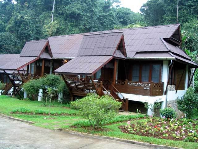
Angkhang Nature Resort
Doi Angkhang, Fang, Chiangmai

Trail Length: ranging from 25km to 80km, mostly asphalt with some dirt roads

Jump-off point:
Starting point is at the Angkhang Nature Resort. This resort is part of the Amari hotel chains - so you will get great rooms, great facilities at 4-star prices. Expect to shell out 100$ US per night. There are other places nearby at backpacker prices (25-40$ per night) though the facilities are quite basic.


The Trip
At the resort, you could get a map outlining bike routes. There are a number ranging from fun rides to the serious 75km loop which goes down Angkhang mountain, go thru Amphur Fang and then up again on the other side of the mountain via Tambol Mae Ngon.

We arrived at 3 in the afternoon. It was 20 degrees Celsius. Wow. For someone spending time in Bangkok and Pattaya, I do not get that often. I was shivering and my teech were ch-ch-chattering by the time I got out of the car and into the reception desk.

There are mountain bikes at the resort for rent or you could bring your own.

The rentals are not so hot though. Just regular ones and not well maintained. They probably asked the head chef to bring back a couple of mountain bikes when he was out doing his daily runs to the market. The bikes are really, really low end. Tires are worn out. I made a quick look at the V-brake and saw that the brake shoe was still there. I guess that should be good enough. Do not even think of lubrication or adjustments, somehow just be glad that all the parts are there when you get a rented one. I wish I brought my own bike.

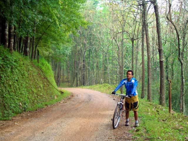
Still, the minute you go out of the resort and head into the mountains -- you do not even really care that the bike is all rusty and rickety, or that the chains skip a beat, or the gears continually get stuck. You forget all that because the view is so breathtaking, the atmosphere is just awesome! Heck, I would even have carried my bike just to be here.

The ride is a 70-30 mix of asphalt roads and dirt roads. The dirt roads are packed and solid so it is pretty easy going. It is pretty hilly. The road curves and follows the terrain ever so gently, so in a minute it could be a short uphill and then a sloping downhill after it.
I left my room at 630am in the morning. It was so cold, I could see mist forming from my breath. The air is crisp, fresh but very thin. For one not used to it, I felt out of breath and was breathing heavily in just a few minutes of pedalling. Maybe in a few days of being here, my body could get adjusted to the thin mountain air.

Bring some sort of eye protection. I was thankful I brought along my goggles. There are a lot of insects flying about, so you need some protection to shield your eyes from small insects.

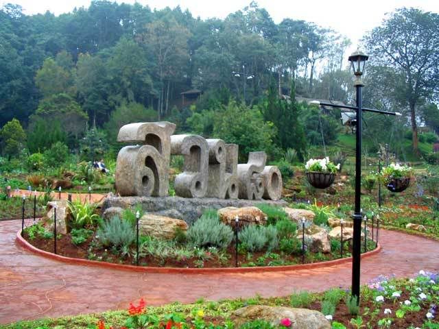
Follow the asphalt road leading away from the resort. You will pass by a bonsai farm and a vegetable plantation garden sponsored by the King's Royal Project. Scenes of serenity abound - farmer watering the plants, hill tribe people strutting about, green trees swaying in the wind and oh! so pretty gardens line the road.

Bring your camera. Take pictures. Take lots of pictures.
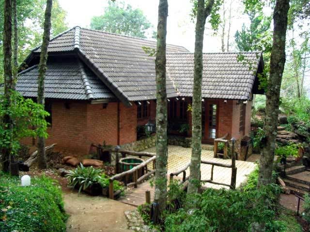
After a couple of kilometers, the asphalt road gives way to a dirt road and the road is now progressively sloped up. You will eventually come across a parking lot, heading into a medium sized teak house. I chatted with the caretakers and they say the Royal Family stops by from time to time in this place when they are in Doi Angkhang.

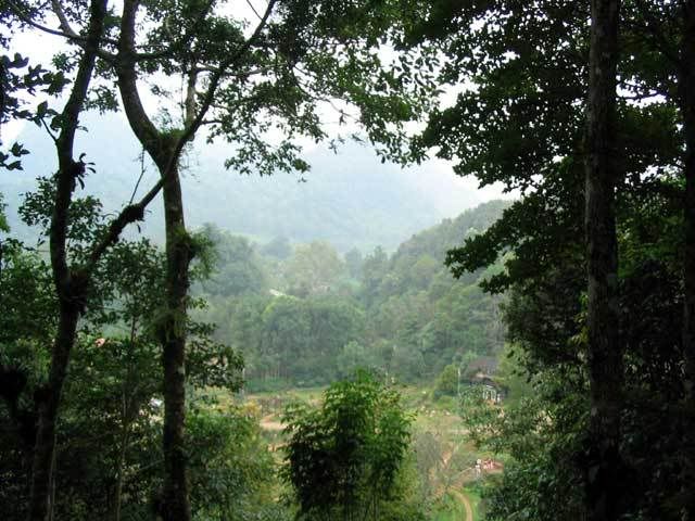
Again, the view from this place is awesome.

After a few minutes break, I decided to ride on up the road. I met someone in a motorbike and asked where the road was headed. To another town 11km up ahead was the answer. Seems reasonable, but my lungs felt they were about to burst. I was getting light-headed already so I decided today was an off-day and headed back. I blame the thin air today.

If I was game, then that would have been 25km back and forth on a decent dirt road. Oh well, maybe next time.
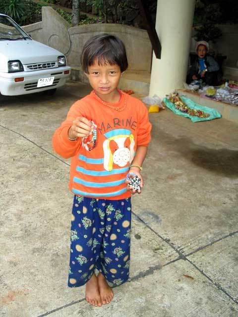
On my way back, I stopped at a small market where hilltribes people were selling their wares. I wanted to buy a trinket or two, but on hearing the price, I decided to buy everyone I know two or three. It was so cheap! and the old lady was so happy I bought so much it felt really good.

I got back to the resort just in time for breakfast. Hmm-mm ... bacon, scrambled eggs and a hot coffee after a morning workout. Perfect.


Trip Value
After Doi Angkhang, me and my friends drove up to the famed Golden Triangle, the point where Laos, Burma and Thailand met each other. This place is infamous, as this was where the opium smuggling and drug trade of a few years back were quite rampant. Now, its just a tourist spot filled with shops and restaurants, overlooking a wide-brown river.

I guess the trip is more for bragging rights to friends on being able to go to the Golden Triangle. So we each took our pictures to earn our bragging rights, had a nice lunch beside the river and headed on to Chiangrai, where we stayed the night.

The trip from Doi Angkhang to the Golden Triangle took a little over an hour and from GT to Chiangrai took a couple of hours.


How to get there
See this map from Amari.

Monday, September 18, 2006

Trip Report: Crystal Bay (Short) XC Track


Location: Bang Phra, Sriracha, Chonburi
Trip Distance: 18kms (2kms XC+16kms tarmac)
Start/Finish: Bang Phra Reservoir Parking Lot

**I found this track by chance on my way back home from my trip last Sunday. This can actually be combined with the first loop at WatKhaoPu for a nice 38km overall weekend fix!

End of the Road. After having my weekend dose of XC fix thanks to WatKhaoPu, I decided to do some exploring on my way back home. Instead of going straight to the BangPhra market intersection and to Sukhumvit (Route3), I turned right after the railroad crossing at BangPhra. I know this road because I used to go here by car but never got any chance or reason to go past the BangPhra railroad station.

To my surprise, the tarmac ends behind the station and it was all mud, grass, and puddles onwards! I saw some tire marks, probably motorcycle, so this road should lead to somewhere my bike can handle, right?


It was all straight, rough, and muddy road with some deep puddles but nothing that my bike can't handle or go around. There are farmlands to my left, between the tracks and Route3. The railroad track is elevated about 10feet to my right.

At the end of this road is a small opening upwards to the railroad track. I decided to dismount and check the tracks first for oncoming train and went back to push my to the gravel and iron.
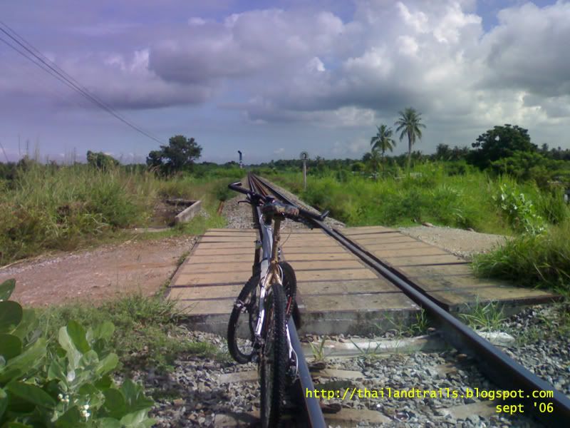
PAY ATTENTION around here for trains, especially on railroad crossings since there isn't the usual road block with lights and bells for warnings on oncoming locomotives!

I went right to cross the first intersection, followed the dirt road down and turn left to cross the railroad intersection again about 500 meters from where I emerged from the XC road.

Turning right after the second intersection led to an easy two-way tarmac with short coconut trees lined on the left side of the road.

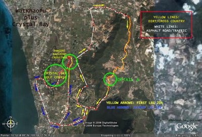
There is an fork less than a kilometer from the coconut trees. I was told by a kind local folk that straigh ahead leads to NongMon bypass and left leads to Crystal Bay golf course. To the left of the fork, by the way, is a small gate to the Mountain Shadow golf course.

Crystal Clear. I was headed for Route3 (Sukhumvit) and wanted more dirt and mud on my bike so I turned left. A few meters ahead is another dirt road to the right which offered an alternative, parallel, and dirty route to NongMon bypass.

Then I noticed that the guard at the rear gate of Crystal Bay was looking at me. He shouted,"Where are you going?" I said Sukhumvit. He said, you can go right through here. "But that leads to the golf course", I said. "Yep, but it's ok for you to ride through. Just follow pathway along the left wall. That should lead you to Sukhumvit."

"You sure the golfers won't mind?"

"Yep."

I was dirty. My bike was dirty. I'm not yet exhausted and I've never been inside this golf course before. I was running out of reasons NOT to go in so I thanked the guy, back on my saddle, and went forward just like the man said.

He was right. The golfers didn't mind me at all. They just went on with their business over the green, putting the golf (finally) into the hole. Well, some of them and the caddies gave the occasional glance since I looked SO out of place in this VERY green and VERY clean playground.

It was so tempting to go fast in this place. Past the club house, the golf carts, and the tri-condos, I was out in Route3, left going back to BangPhra and right to Bangsaen beach.

Trip Report: WatKhaoPu MOD 1


Location: Bangphra, Sriracha, Chonburi
Trip Distance: 20kms
Start/Finish: BangPhra Reservoir Parking Lot

Jumpoff Point: This loop starts and ends at the BangPhra Reservoir parking lot. Reasons why I usually recommend this place for starting/finishing a loop around this area are that it's guarded, nice breeze from reservoir/lake nearby, and excellent broiled chicken and thai kebabs across the street. Yum! Again, my map shows this start/finish point at the Reservoir instead of my house.

Fresh Marks. One thing about making plans is that they can always change, unexpectedly, in the last minute. Our group ride was cancelled so I decided to do a time trial on the trail I found last week.

A couple of minutes into the track, I noticed tire marks on the ground. It rained the day before so the tires made a clear impression. It didn't occur to me how fresh they were but something tells me that I was going to find soon.

Past the first clearing I saw them - two bikers one hundred meters ahead of me. One of them was wearing a yellow jersey which stood out against the thick green grass which lined the sides of the trail. I did not want to catch up with them so I decided to stop and give two minutes distance between us. After that I moved on and just to make sure that I won't catch up, I checked out the side trails I noticed last week.

These side trails made for some interesting mini-loops of slow uphill and fast, winding downhills to keep things interesting with two spotting places for small jumps.

Slow Down. Back on the main trail, I spotted the same group of bikers I saw earlier. It turned out that there were six of them. I thought they stopped to rest. As I got closer, I noticed that the one who was on a Giant XTC FS was having a mechanical. The rest of the guys were on HTs.

I said Hello! and they almost jumped when they saw me coming. I would have gone past them when the guy on the FS said "Hey slow down and join us!" I was a bit hesitant at first because I don't want to play catch-up with these guys who look like seasoned riders. But one of them had a problem with his bike so that should slow him down a bit, right? SO I figured, what the hell and said OK.

KungFu MOD1. Another minute or so, we were back on the trail. The previous night's rain made for some deep puddles and loose, slippery ground. I was riding at the back, murmuring (to my bike and myself) "Don't crash, don't crash, don't crash". The sixth man occasionally looked back to see where I was only to see me 4-5 feet behind. I looked at my computer and saw that we were running close to 20kph, splashing through mud and puddles.

Approaching DETAIL A, instead of going straight, the group made a sharp turn to the right, to a steep uphill along the bamboo line. Lots of rocks on this moderate climb.

And it's all downhill from there, go to warp speed if you can. Please don't forget that this is still a graveyard so respect it and resist the urge to huck it over the mounds!

Tuesday, September 12, 2006

Trip Report: BangPhra Reservoir to Wat PaKhaoPhu


Location: Bang Phra, Sriracha, Chonburi
Trip Distance: 20kms (10kms asphalt/tarmac, 10kms dirt)
Start/Finish: Bang Phra Reservoir Parking lot

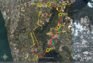
Jumpoff Point: The trail starts at point marked Detail A on the map from a 10km "warmup" ride on asphalt with very, very light traffic. The jumpoff is blocked by a makeshift gate to prevent light vehicles such as motorcycles and small 4x4 trucks from entering.

LAZY SUNDAY.
Our group trip was cancelled for reasons only known to God himself so instead of spending the rest of the day playing DOTA, I decided to get off my ass and on my bike and look for the trail I've read in one of the threads at the Thai MTB forum.

Obviously, my trip started at my house at nearby Bangsaen. But for those of you who are interested in checking out this trail, I've marked the Start/Finish point at the Bang Phra Reservoir parking lot. Exit the parking lot, turn right at the gate and then turn left at the T-intersection with the golf course to your right.

This road leads to an intersection marked DETAIL_B in the map. Turning left leads to a road very much under construction for about 600 meters. Lots of dust and gravel. Not much traffic but this should change once the road is finished as this road leads to Route 7 Motorway going to Bangkok.

Roughly 2kms from the intersection is a fork marked DETAIL_C in the map. Straight ahead will eventually lead to Route7 Motorway, turning right leads to the jumpoff point. I was chased by a very BIG dog from the house near this fork. The mountain is on the right side of the road. There are some trails leading to the mountain before the jumpoff which I'm sure leads to somewhere.

KEEP OUT?
Past the meditation center and rock quarry, I noticed the sheet gate to the right which matched the description and photos in the forum. I dismounted and carried my bike through the gap on the right side of the gate. Saddled, prayed, and off I went into the unknown.

The trail mostly fireroad with short singletrack sections. I can tell that it has been unused for quite some time by the thick grass unchecked on the sides and some vegetation reclaiming the packed soil on the trail. I did not bring eye protection so I had to shield my face from the thick grass early on. I occasionaly made loud clicking noises with my hand brakes to warn sleepy unsuspecting snakes.


I also noticed signs of alternate routes on the side of the track which shows that there was once a network of trails here for different levels of skills and fitness. I decided to go straight ahead, one exploration at a time.

BIG BREAK!
Beyond the trees and thick grass is a clearing overlooking Route7 Motorway. The sky looks very unfriendly. A ride on an unused trail in the rain sounds VERY inviting but not today, no sir.

I turned right with the Motorway on my left and the mountain on my right. This leads to a fork marked DETAIL_D on the map. I think the right path leads to the mountain trail. Mental note to bring machete next time and clear this path which I heard was once a competition race track.

ARROWS GENTLEMEN!
Then finally, a sign! Whew! I'm now officially un-lost. The sign is one of the familiar markers left by MTB groups from the popular LBS's here in Chonburi. Most of the trails around here are marked by these and I expect to see some more ahead and around the corner.

There are also no no entry markers indicating either housing/settlement, grazing field,bike hazard, or don't-cut-this-tree-dumbass!. Since I'm biking alone, I figured the locals wouldn't mind, I can outrun the cows, can always dismount, and am without an axe. I also forgot the symbol for mine field so I just ignored the sign and went ahead.

Sure enough, the trail is littered with these markers which I'm not sure were placed to help or confuse the rider. The markers are almost always nailed on trees and coconuts. They will almost always be behind thick vegetation and grass.

Then a pineapple field with real pineapples! A few more weeks and these babies will be ready for the picking and this field will be filled with the stench of rotten fruit and fruit flies.

WHERE ARE THE VILLAGE PEOPLE?
After couple more of confusing trail marks and through no entry X's, I found what used to be a settlement for a group of charcoal makers:

What used to be an area filled with, I guess, smoke and scraps of wood remains black soot and signs of human habitation. Old toys and makeshift chicken cages left behind to show that people once lived here. Watch a short video of this place here

Upon reaching the next fork Detail E in the map, I felt something was terribly wrong with my bag when it finally gave in to the abuse I've been giving it. I had to tie it with my handkerchief and constantly remind myself not to get carried away riding the rest of the track and unknowingly lose everything like a gingerbread trail behind me.

To the right of the fork Detail_F leads to sugarcane fields (and maybe a link to that racetrack) but I decided to make my damaged bag as an excuse to end this trip quickly, ignore that route, and go straight.

EXIT PLAN.
A little bit of exploration at Detail G rewarded me with a very short burst of adrenaline downhilling to a small pond and eventually a dead end. That reward was generously returned when I hammered my bike uphill back to the main route.

A few more turns and up front I could see the Chinese Cemetery. So much for night riding here for me. Some graves have already been dug to make way to new tenants. This view is totally in contrast to the one opposite the cemetery. The mounds on the foreground are Chinese graves (or freeride jumps, depending on where and how you look at it). The mountain on the backdrop is a part of the range surrounding Khao Keow. There should be a trail around there somewhere!

Straight ahead and around the undertakers' cabins is just dirt road used by vehicles going in and out of the cemetery. There are people walking around doing their business of offering flowers to their beloved.

Unlike the confusing markers on the trail, the markers on this VERY wide dirt road were VERY clear and consistently pointing at the same direction. Seems like everybody knows how to get out of this place and would like to share that information. I wonder how many bikers have already been misled by these outdated markers only to get lost in the network of tracks beyond the graveyard and into the woods?

Fitness Level.
Beginners to "Occasional" Weekend Warriors. The first leg of the trip on asphalt can burn you out if you're not fit or not careful.

Technicality.
None. This is definitely Beginners-Build-Your-Endurance Level. This loop can cheer up a lot of people from those who are breaking-in their new bikes, son-and-dad trip outdoors, or speed-freaks looking for a bit of a cross-country fix.

Trip Value.
Hungry? No problemo, Bangsaen and NongMon market is less than 20 minutes away to the north and Sriracha is around the same distance away to the south. Drop by the beach, get a shuteye if you're tired or wake up that triathlete in you and do a few strokes. Richard talks more about Bangsaen Beach in his blog.

Aside from food, both these places (Sriracha and Bangsaen) have other places of interests such as movie theaters, shopping plazas, and a marine museum...among other things.