
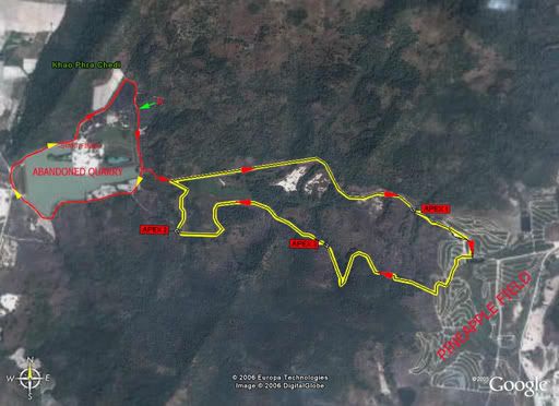
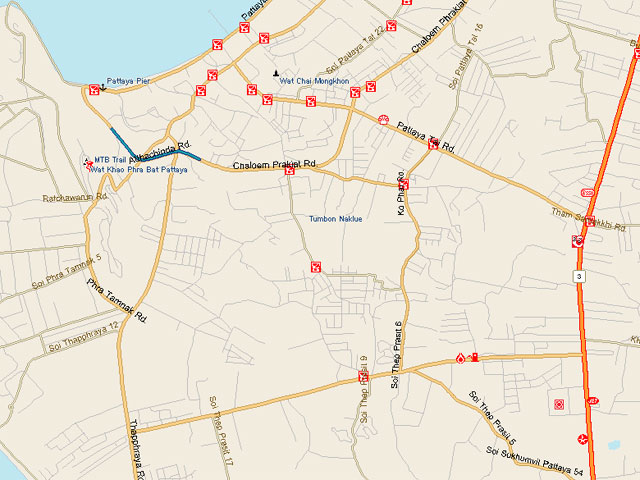
Location: Khao Mai Gaew Reservoir, Banglamung, Chonburi
Trail Length: 11km (long loop), 7km (short loop)
Jump-off Point:
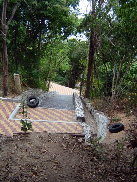
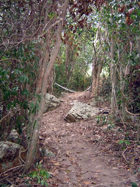
Starting from the parking lot, you head into a small fireroad on the left side of the reservoir. A couple of hundred meters and you will see a singletrack heading away to the right. Get in, and you're on!
The Trail:
 As this is a popular destination, direction arrows litter the trail. You will also observe that there are signs with orange and red triangles. These signs indicate that the trail is a mountain bike trail (orange triangle) or a motocross trail (red triangle)!? Or is it the other way around?
First up will be a curvy singletrack alternately ascending and descending. The track is sandy and loose on a sunny day, but hard and rut-lined if there had been recent rains. This section will get you nicely-warmed up. Watch out for loose sand on the curves.
Abruptly, you will come across a crudely constructed wooden gate. Keep it always closed, even if you find it wide-open when you get there. Reason is that there are domesticated cows in the area and the gate prevents them from wandering into the vegetable patches that litter the area. You dont want to meet an angry farmer on your next ride - keep the gate closed.
Again, curves and zigzags, but this time slightly ascending and full of tree roots. Yep, at this time you should have worked out quite a sweat and should be starting to get tired from lifting your handlebars over roots. Its wise to set the front suspension to a softer setting and the tire pressure on the soft side.
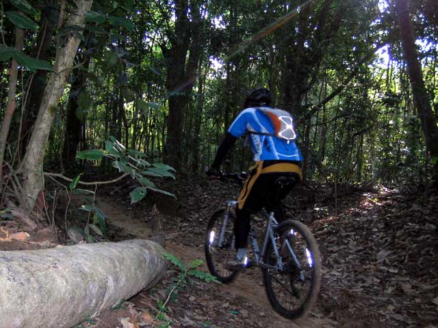
 Take particular attention to tree roots on quick switchbacks, make sure that you have landed squarely on the other side of the root before you jerk the handles to change directions. Change directions too quickly and you might land awkwardly on your front tires.
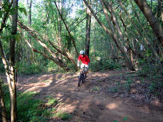 After this zigzag-gy section, you will then arrive at a narrow long, long and steep uphill. This is the first uphill section and easily separates who has been good during the week and who has been spending too much nights partying.
Dont worry, rest area up ahead. At the top of this long climb, the trail forks to the right and left. Trail to the right is hardly used and is very technical. At most times, its just too unkempt to ride in. At certain times of the year, somebody cleans up the trail, cuts the undergrowth and can be used.
The trail to the left is the more traveled one. Head to this one. Dont forget to change settings of front fork to downhill mode, as this is a long semi-steep descent. For most, this is the fun section .
 At the bottom, watch out for rain ruts running parallel to the road, as your front tires could get caught in them. Cruise along until you reach a dark patch of forest.
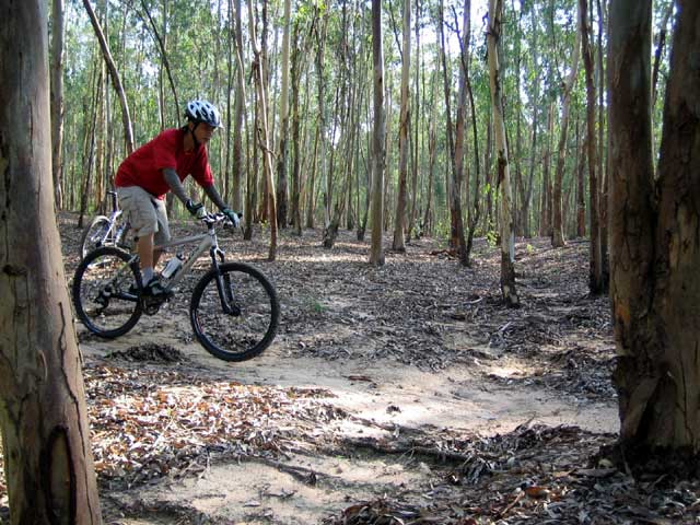
Again, you will reach a fork up ahead. Fork to the right is a short cut, while the one on the left leads to a eucalyptus forest. Very nice and otherwordly. Just to see this section makes it worth the extra kilometers. Any forks on the trail that you see, just take right turns. Direction arrows will also guide you on this part. There will be an 'X' to tell you where not to go.
Next up, would be two succeeding uphill climbs with a short downhill between them. Curvy and steep, the uphill climbs are quite a mental challenge. Grit your teeth, give your quadriceps a huge pep talk and start working.
Most riders would go at it until the 3rd peak, and then take a short breather. There is a short clearing which is cool and shady. Find a good spot to rest and be familiar with the place. You will definitely come to stop here on future trips to tam pratoon.
From here, its all downhill -- Yay! Not quite. The downhill section is strewn with boulders and quite steep. Very scenic, but who can enjoy the view while watching out for rocks on the trail. Rain ruts also add to the difficulty. Keep to the left, if in doubt. The best lines are normally on the left side of the trail. Add a bit of caution when riding through this section.
At the foot of the hill, it is all easy-going from here on. Still twisting and turning, just follow the singletrack and then suddenly, you find yourself on the same parking lot that you left. Wow, at this time, that would seem ages ago. Go sit down and rest on the pavilion and think about the ride. Give it a few minutes, you might want to have another go.

 This time, look at the scenery. It is really beautiful.
Fitness Level:
You should be fit if you want to tackle this course in one go. The uphill climbs, there are 3 of them, would definitely humble you.
Technicality:
This course is a technical one. There are a lot of switchbacks - alternating both uphill and downhill. And there are a lot of tree roots across the trail. Can be slippery especially after a monsoon rain. The roots make it harder to climb, and make it tricky on the short descents.
Be careful on the quick turns, as the roots make your front wheel 'jumpy' and lose grip as you change directions. I know its basic stuff, but keep both your hands firmly on the handlebars and your concentration fixed. Add to that some loose sand and you will lose control of your ride rather quickly if you start daydreaming.
 Tires should be a bit soft from what you are normally accustomed to lessen the jarring on the front tires.
On the descents, beginners would balk and think twice on these, especially on the third and last one. This is a long steep descent littered with big boulders. If its your first try, be conservative and learn the best lines to take, as picking a bad line could easily send you flying over the handlebars.
Trip value:
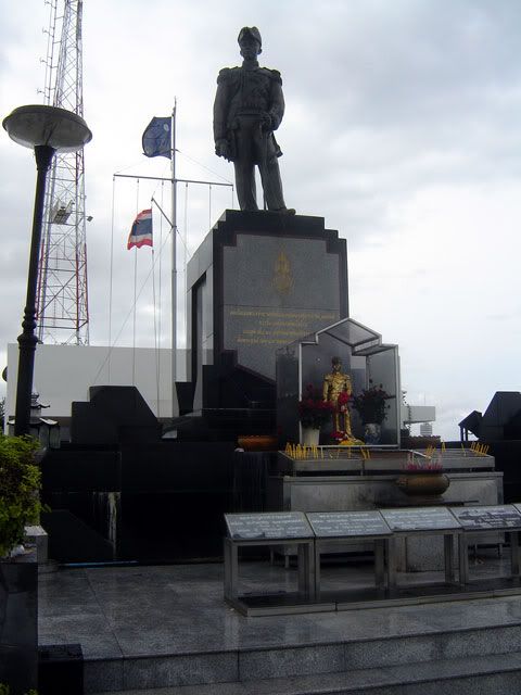
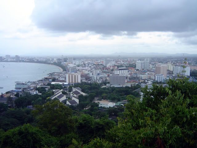
Being half an hour drive to Pattaya, need I say more? A day on the beach, beer on the evening till 2am -- you probably know more about it than i do.
How to Get There:
 If you are coming from Bangkok, take the Motorway (Rd.7) and follow this until you reach Kratinglai Junction, which is the huge cloverleaf splitting the road heading to Pattaya and to Rayong. Take the left turn to Rayong (Rd.36) and begin to slow down. About 1.5km from the junction, turn left Rd.3240.
Travel about 6km into Rd.3240, and you will arrive at a small country road with a big colorful sign beside it (if you arrive at a 4-way intersection with traffic lights, you'd have missed it and need to backtrack now. Dont lose your cool now, just make a U-turn on the PTT gas station. Its 900 meters from the intersection, but now its on your right side).
Turn left into the country road and about 500 meters, you will arrive at a big garden and a parking lot beside a medium sized reservoir. Make a sigh of relief and get ready to have fun!
[end]


